The 60-second version
The Georgian Trail is a 32 km converted rail trail running from Meaford through Thornbury and Collingwood to Wasaga Beach. The Wasaga-to-Collingwood segment is roughly 18 km of paved or stone-dust hard-packed trail, almost entirely flat (less than 2% gradient throughout), wide enough for two-abreast cycling, and the local long-distance cycling commuter spine. For Wasaga residents, this is the everyday cycling venue: low-traffic, scenic, no commute-route hill repeats. For visitors, this is one of the longest contiguous flat-cycling experiences in Ontario outside the Niagara region. Bikes from hybrid/commuter to road-with-thicker-tires all work; pure narrow-tire road bikes will feel the stone-dust sections in summer. Free, year-round (with appropriate weather gear), connects to other multi-use corridors at the Collingwood end.
The trail end-to-end
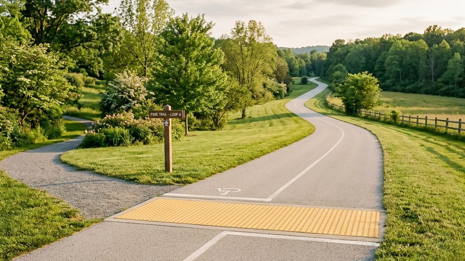
The Georgian Trail’s full length is 32 km from Meaford in the west to Wasaga Beach in the east. The Wasaga-to-Collingwood segment specifically runs from the Sunnidale Road Wasaga trailhead 18 km west to Heritage Park in central Collingwood. Surface specifications: 2.4 metres wide throughout, paved asphalt for roughly 60% of the route, stone-dust hard-packed for the remaining 40%. Less than 2% gradient end-to-end with a few short rolling sections.
Trailhead access points along the route:
- Sunnidale Road (Wasaga eastern terminus) — ~30 cars parking, washroom seasonal.
- Klondike Park — mid-route Wasaga access, ~15 cars, washroom seasonal.
- Highway 26 connector — mid-route bridge crossing with small pull-off.
- New Lowell Conservation — midway between Wasaga and Collingwood, ~20 cars, washroom seasonal.
- Cranberry Trail East (Collingwood) — near the Collingwood end, multiple parking options.
- Heritage Park (Collingwood western terminus) — ~40 cars parking, year-round washrooms (Town facility).
The Town of Collingwood and Town of Wasaga Beach jointly maintain the trail through the Georgian Trail Association — a non-profit funded primarily through annual passes and donations.
What the ride feels like
The Wasaga-to-Collingwood direction is the most-cycled direction (slightly downhill net elevation, plus the Collingwood end has more services). Average riding times for the 18 km one-way:
- Casual hybrid pace (16-20 km/h): 55-70 minutes one-way.
- Fitness pace (22-26 km/h): 40-50 minutes.
- Trained road pace (28-32 km/h): 35-40 minutes.
The ride passes through three distinct landscapes: agricultural fields and hedgerows on the Wasaga end, mixed forest in the middle section near New Lowell Conservation, and the more developed Collingwood-area light commercial-and-residential strip on the western end. Visual variety is solid; the trail isn’t monotonous.
Wind is the main variable. The Georgian Bay shoreline corridor channels prevailing west-southwest winds along the trail’s axis, which means a comfortable Wasaga-to-Collingwood ride often becomes a slog on the return. Plan accordingly: if there’s a 25 km/h southwest wind, the return ride takes 30-50% longer than the outbound at the same effort.
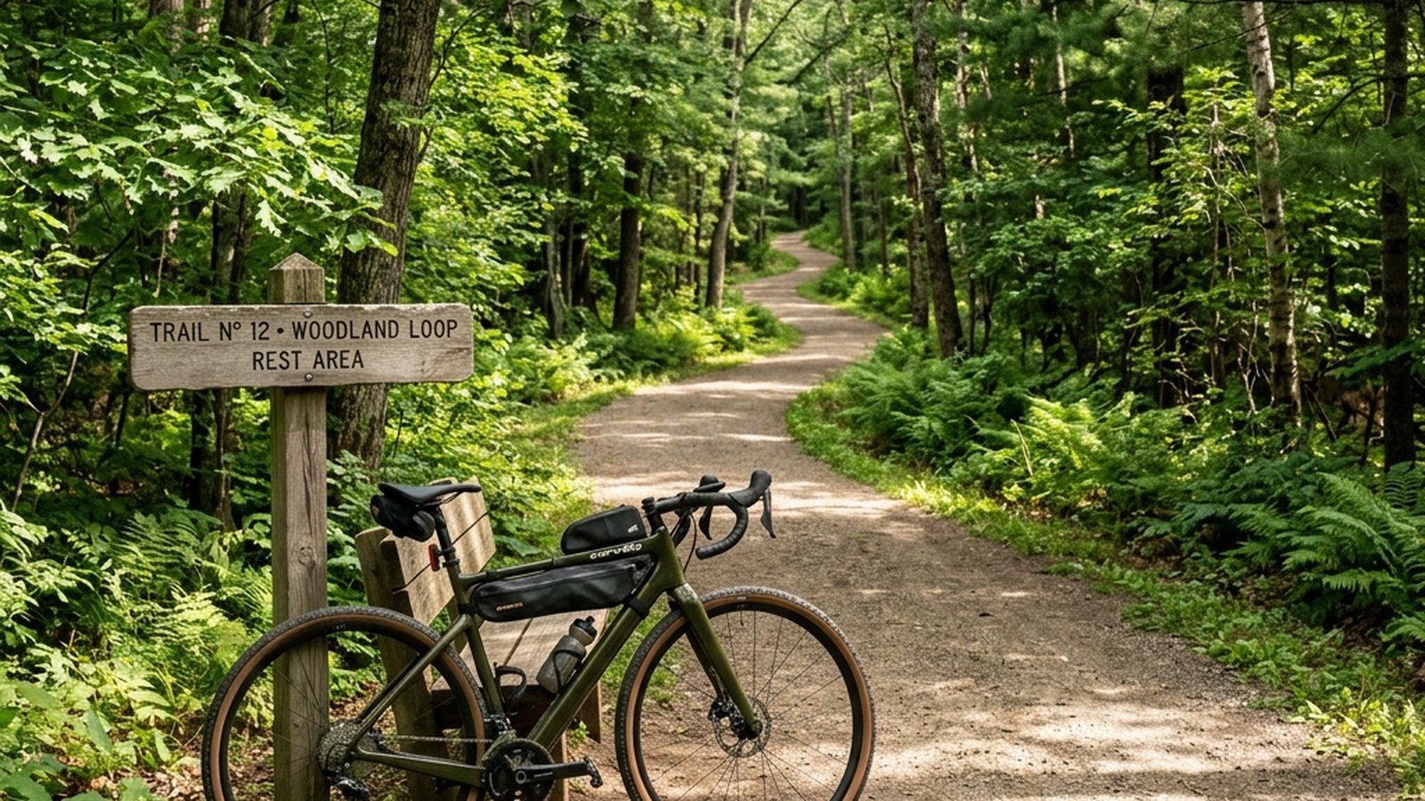
What bike works on this trail
The trail’s mixed paved-and-stone-dust surface is most suited to:
- Hybrid/commuter bikes (28-35 mm tires): ideal. The stone-dust sections feel comfortable, the paved sections aren’t under-tired.
- Gravel bikes (35-45 mm tires): excellent. The slightly knobby gravel-tire profile handles the stone-dust transitions seamlessly and rolls almost as fast as a road tire on pavement.
- Cyclocross bikes: work well, similar to gravel bikes in this context.
- Mountain bikes: overkill. The knobby tires drag on the paved sections and the suspension is unnecessary. Faster on hardtail than full-suspension; either works but isn’t the right tool.
- Pure road bikes (23-25 mm tires): the stone-dust sections will feel hard underfoot. Doable but not enjoyable for the full 18 km. Better choices exist for fast road-paced cycling in the area (Highway 26 corridor when traffic is light, the Niagara Escarpment loop south of Collingwood).
For visitors without their own bike, several local rental shops in Collingwood and Wasaga rent hybrids or gravel bikes by the day or half-day. The Collingwood end has more rental options (closer to the larger tourism market); Wasaga has 2-3 small operations during the May-October peak.
Seasonal considerations
Spring (April-May): the trail is open year-round but the spring melt produces mud patches at low-lying sections through April. Mid-May is the practical season opener. Bug pressure low.
Summer (June-August): peak season. The trail gets meaningfully busier on weekends — 50-100 riders per hour at the most-used midday sections is typical on a sunny Saturday. Early morning (before 9 am) and weekday afternoons are quieter. Mosquitoes in the New Lowell Conservation forest section after rain.
Autumn (September-October): the autumn-colour ride is the local trail’s signature visual experience. Cool, dry, low traffic, mid-October peak colour. Plan extra ride time to actually enjoy the views; this is the wrong month to push for a fast time.
Winter (November-March): the trail is not maintained for cycling in winter — snow accumulates and stays. Some sections are used by cross-country skiers and snowshoers; do not cycle on these. The Town of Collingwood’s portion sometimes gets partial plowing for foot traffic; the Wasaga section does not. Winter cycling on the Georgian Trail is not a thing.
What connects at each end
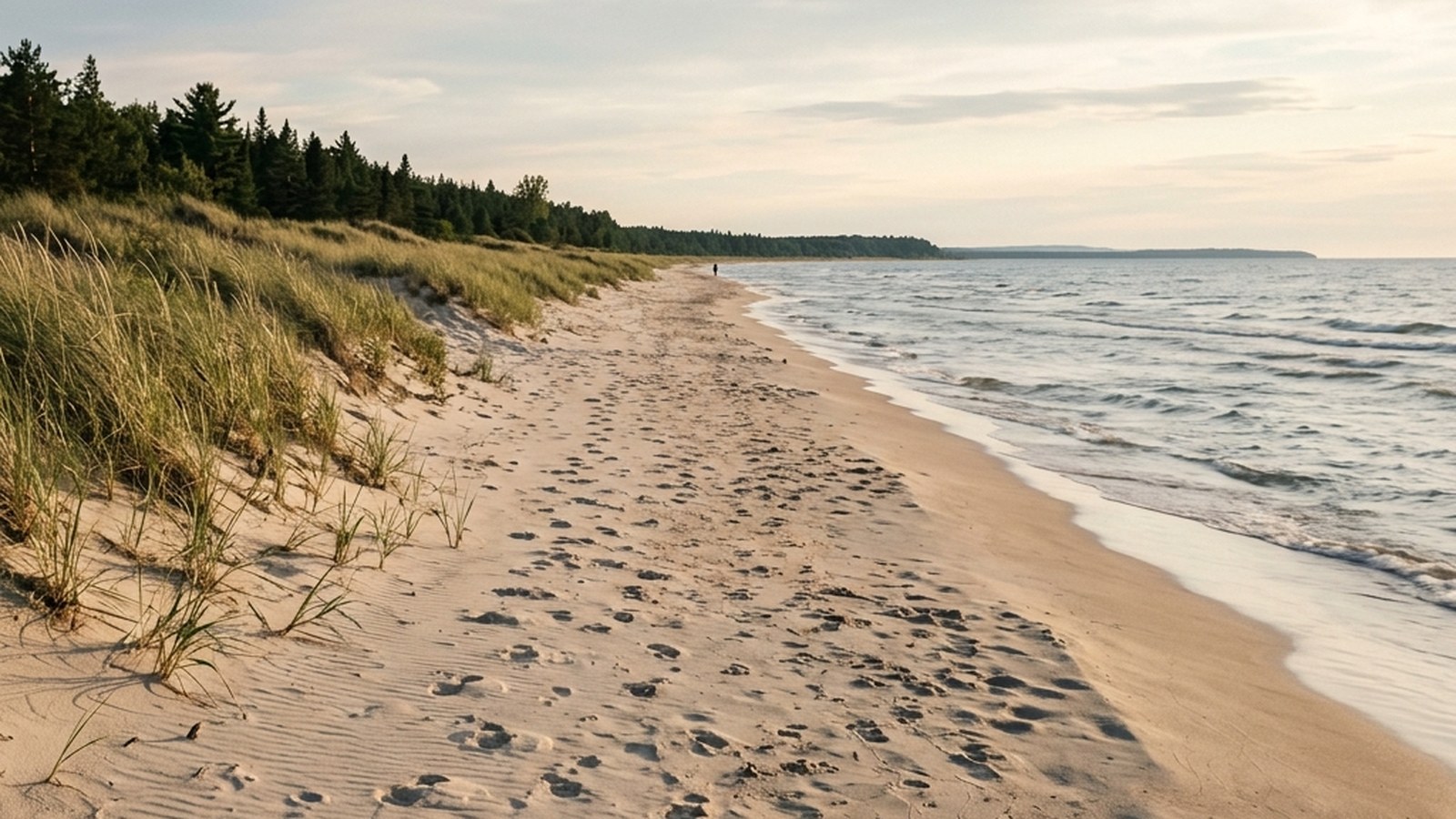
At the Wasaga end, the Georgian Trail connects (informally, via short on-road segments) to the Wasaga Beach multi-use corridor along Beach Drive, which extends the contiguous cycling distance another 13.7 km along the beach. So the practical maximum continuous Wasaga ride is roughly 32 km combined (Heritage Park Collingwood to Allenwood Beach Wasaga).
At the Collingwood end, the Georgian Trail connects to multiple urban trails: the Cranberry Trail (extends north to the Collingwood waterfront), the McCullough Trail (south toward Blue Mountain), and the Collingwood waterfront promenade. For visitors making a multi-day cycling trip, Collingwood is the practical hub for stitching together rides; Wasaga is the practical eastern endpoint.
Practicalities
- Cost: the trail is free for casual day use. The Georgian Trail Association annual pass ($35 individual, $50 family) supports trail maintenance and includes a printed map and members’ newsletter.
- Parking: all six trailhead parking lots are free.
- Washrooms: seasonal at most trailheads (May-October). Year-round at Heritage Park Collingwood.
- Water: none on trail. Carry your own; refill at trailhead taps in season.
- Cell coverage: reliable Bell and Rogers throughout.
- Cyclist etiquette: ring bell when passing, slow for pedestrians and dog walkers, give space at trailheads.
- Repair stations: three self-service repair-stand stations along the route (basic tools and a pump). Useful for a flat fix; for serious mechanical issues, the Collingwood end has multiple bike shops.
Building a multi-day Georgian Trail experience
For visitors planning a longer cycling visit, the Georgian Trail can anchor a multi-day itinerary. A reasonable 3-day pattern:
- Day 1: arrive in Wasaga, ride the 13.7 km Beach Drive corridor to Allenwood and back. Easy intro day.
- Day 2: Wasaga to Collingwood return (36 km round trip on the Georgian Trail), with lunch at the Collingwood waterfront. Full-day commitment.
- Day 3: Collingwood-area exploration via Cranberry Trail and McCullough Trail, or a one-way ride from Wasaga to Heritage Park Collingwood (18 km) with shuttle return.
Accommodations cluster in both Wasaga and Collingwood; the Collingwood end has the larger tourism inventory (hotels, B&Bs, vacation rentals) but Wasaga offers waterfront-direct options unavailable in Collingwood. For multi-day cyclists, basing in Collingwood and shuttling out to Wasaga for ride starts is the practical approach — more services, more food options, easier evening logistics.
Beyond the Wasaga-to-Collingwood segment
The full 32 km Georgian Trail extends west from Collingwood through Thornbury to Meaford. The Collingwood-to-Thornbury section (12 km) is mostly paved through more open agricultural country with periodic small-town intersections. Thornbury-to-Meaford (10 km) returns to a more wooded character and ends at the Meaford harbour. For visitors with an extra half-day, the full west-to-east traverse from Meaga to Wasaga is one of the longest single-day cycling experiences available in the South Georgian Bay region (~32 km point-to-point requiring a shuttle).
Practical takeaways
- 18 km of paved/stone-dust trail connecting Wasaga to Collingwood. Less than 2% gradient throughout.
- Average ride times: 55-70 min casual, 40-50 min fitness pace, 35-40 min trained.
- Hybrid or gravel bike is the right tool. Pure road bikes feel underdone on the stone-dust; mountain bikes are overkill.
- Wind off Georgian Bay is the main variable. Plan return-ride time in any wind >15 km/h.
- 32 km maximum contiguous ride when you connect with the Wasaga Beach multi-use corridor (Allenwood to Heritage Park Collingwood).
References
Georgian Trail AssociationGeorgian Trail Association. Trail surface specifications, annual passes, and maintenance funding. View source →McGregor 2018McGregor RA, et al. Trail running biomechanics: surface variability and lower-limb loading. Journal of Sports Sciences. 2018;36(4):420-428. View source →Environment CanadaEnvironment Canada. Prevailing wind patterns along the Lake Huron and Georgian Bay shoreline. View source →