The 60-second version
Petun Conservation Area is a 96-hectare property managed by the Nottawasaga Valley Conservation Authority (NVCA) about 30 minutes south of Wasaga Beach near Stayner. It’s the only local trail network where significant Indigenous and post-Contact archaeological history is integrated into the trail experience. Named for the Petun (Tionontati) people whose 17th-century villages occupied this region of southern Ontario before the Iroquois Wars of the 1640s, the conservation area protects archaeologically significant terrain alongside a 6.4 km network of forest trails. The trails themselves are moderately rolling with one notable climb to a viewpoint overlooking the Pretty River valley. NVCA day-use fee: $5/person or $35 annual pass. Open year-round. Best for hiking with a slow-paced interest in regional history; less remarkable as pure trail running compared to Pretty River or Blue Mountain.
Why this conservation area is named what it is
The Petun, also called the Tionontati or Tobacco Nation in colonial-era records, were an Iroquoian-speaking confederacy of seven villages occupying the southern Georgian Bay region from roughly 1300 to 1650 CE. Petun villages clustered along the Niagara Escarpment’s eastern face, including documented sites in what is now the Petun Conservation Area itself. The villages were palisaded, with longhouses and surrounding agricultural fields growing maize, beans, squash, and the tobacco that gave the nation its colonial name.
The Petun Confederacy ended abruptly in 1649-1650 when Iroquois (Haudenosaunee) attacks during what European historians later called the Beaver Wars dispersed the Petun villages. Survivors merged with the displaced Wendat (Huron) communities, eventually forming the modern Wyandot Nation in Quebec, Michigan, and Kansas. The archaeological record at Petun Conservation Area includes documented village sites and burial features that the NVCA explicitly protects as part of the conservation mandate.
The trails themselves were routed in consultation with descendants of the Wyandot Nation and Indigenous archaeology consultants to avoid sensitive sites while making the broader landscape accessible. Some trail signage references this history; deeper context is available through the NVCA visitor materials and through guided walks the NVCA occasionally hosts in partnership with Wyandot Nation cultural representatives.
The trail network
Petun has four signed trail routes totalling 6.4 km within the 96-hectare property:
- Maple Loop (1.8 km) — flat hardwood forest. Beginner-friendly, stroller-accessible in dry conditions.
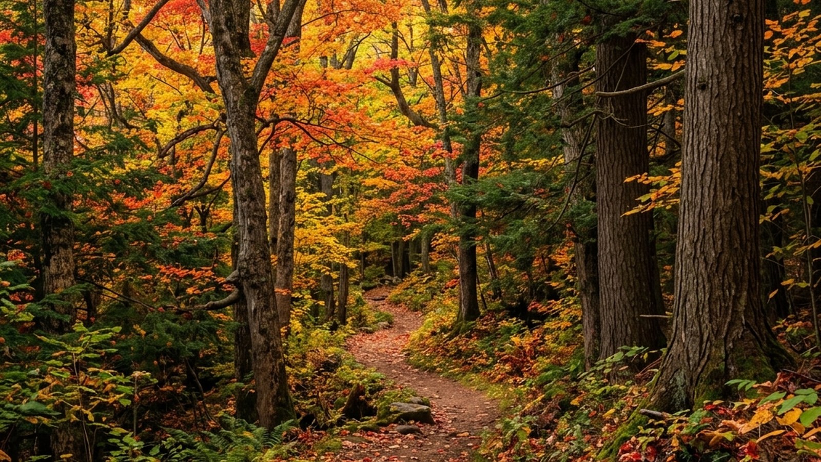
- Cedar Loop (2.6 km) — rolling forest with cedar and balsam-fir sections. The standard everyday hiking route.
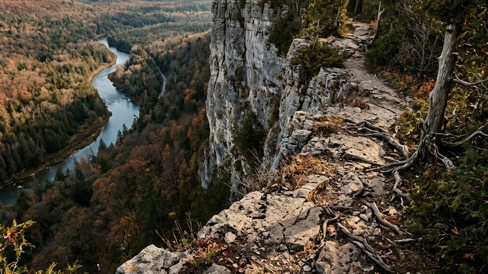
- Lookout Trail (3.2 km out-and-back) — climbs to a viewpoint above the Pretty River valley with the property’s best view. About 60 m elevation gain.
- Full Perimeter (combined, 6.4 km) — combining all loops; the longest single outing the property supports.
All trails are blazed in NVCA’s standard yellow-arrow pattern. Junctions are signed. Free maps are available at the trailhead kiosk year-round.
What you can and can’t see archaeologically
The trail experience integrates the historical context without exposing sensitive archaeological features. Visitors won’t see exposed village remains, longhouse foundations, or burial features — these are protected under both the Ontario Heritage Act and NVCA conservation policy. What you can see:
- Trail signage at the lookout viewpoint references the Petun villages that occupied the broader region.
- The landscape itself — the gently rolling forest terrain, the proximity to the Pretty River for water access, and the Niagara Escarpment ridge to the south are all factors that made this region a viable Petun village location.
- Forest stand transitions from younger maple regrowth to mature cedar reflect post-Contact land-use changes after the villages dispersed; an experienced ecologist can read the forest as a kind of historical record.
For visitors interested in more direct archaeological context, the Wyandot Nation has cultural-tourism offerings (visit the Wyandot Nation of Anderdon’s website for current programs) and the regional museums in Midland and Penetanguishene have permanent exhibits on the Wendat-Petun cultural region.
A note on land acknowledgement and respectful visiting
The Town of the Blue Mountains land acknowledgement recognises that the area is part of the traditional territory of the Anishinaabeg, Haudenosaunee, and Wendat-Tionontati nations, with the Petun specifically connected to this immediate region. Visiting Petun Conservation Area is a small but meaningful act of acknowledging this history rather than abstracting it.
Practical respectful visiting: stay on the marked trails (off-trail movement risks disturbing archaeologically significant terrain), don’t collect artefacts of any kind (collection is prohibited under the Ontario Heritage Act and is harmful to the cultural record), and approach the property as you would any place of historical significance — with curiosity rather than entitlement.
Seasonal considerations
Spring (April-May): spring ephemerals (trillium, trout lily, hepatica) bloom in the maple forest sections. The Lookout Trail is muddy in early spring; allow a few weeks after major snowmelt before attempting it.
Summer (June-August): mosquito-heavy in the cedar forest sections. Bug spray and a head net for sustained efforts. The Lookout Trail is exposed at the viewpoint and hot in midday sun.
Autumn (September-October): peak season. The maple forest sections turn red and orange by mid-October; the viewpoint above Pretty River valley produces the property’s strongest visual experience this time of year.
Winter (November-March): the trails remain open but the Lookout Trail’s climb ices over by late November. Snowshoers use the property; standard winter trail precautions.
Practicalities
- Day-use fee: $5/adult, $3/child, or NVCA annual pass ($35 individual). Self-serve payment box at the trailhead.
- Parking: ~20 cars at the trailhead lot.
- Washrooms: seasonal (May-October) pit toilet at the trailhead.
- Water: none. Carry your own.
- Cell coverage: reliable at the trailhead and viewpoint; spotty in the deeper forest.
- Dogs: permitted on-leash. Off-leash is prohibited because of nesting waterfowl in adjacent wetland areas.
- Drones: not permitted.
- Cycling: not permitted on the trails.
Where it fits in the local rotation
Petun is a hiking-and-history venue rather than a serious trail-running venue. The 6.4 km of total trail is enough for a 60-90 minute hike with the historical interpretation, but it’s not a destination for sustained running training. For Wasaga-area residents the practical use is occasional — a 2-3 visits per year hike-with-out-of-town-family kind of venue, particularly worth doing once with someone who has cultural roots in the region.
Pairs naturally with a stop at Pretty River Valley (5 minutes north) for a longer day combining Petun’s hiking-and-history with Pretty River’s harder trail running. For a fully cultural day, combine Petun with a visit to the Huronia Museum in Midland (45 minutes east) for the Wendat-Petun exhibits.
Pairing this with the broader Wendat-Petun cultural tourism circuit
For visitors specifically interested in the Indigenous cultural context, Petun Conservation Area is one stop in a broader regional circuit. The Huronia Museum in Midland (45 minutes east) has the strongest permanent exhibits on Wendat-Petun material culture. Sainte-Marie among the Hurons (a Parks Canada national historic site, also in Midland) is a reconstruction of the 17th-century French Jesuit mission that interacted directly with the Petun villages. The Wyandot Nation cultural centres, while geographically distant (Quebec, Michigan, Kansas), offer online programming and the occasional in-person visit during cultural events.
A reasonable cultural-tourism day combines a morning at Petun Conservation Area for the landscape and trail experience with an afternoon at the Huronia Museum for the artefact-based context. Building this kind of cultural literacy benefits from the combination — the landscape without the museum is too abstract; the museum without the landscape is too contained.
Seasonal NVCA programming worth knowing about
The Nottawasaga Valley Conservation Authority hosts a small but substantive programming calendar at Petun Conservation Area each year. Spring includes a guided wildflower-identification walk in late April or early May, timed to the spring ephemerals in the maple sections. Summer sometimes includes Indigenous-history-focused walks in partnership with Wyandot Nation cultural representatives, depending on representative availability. Fall typically includes a forest-ecology walk timed to autumn colour. Winter has occasional snowshoe-and-tracking events.
The events are advertised primarily through the NVCA email newsletter and Facebook page. Most are free with the standard $5 day-use parking fee or NVCA annual pass. Booking 1-2 weeks in advance is sensible for the Indigenous-history events specifically because they’re capped at 12-15 participants for the kind of small-group conversation the cultural-context format requires.
Practical takeaways
- 96-hectare conservation area 30 minutes south of Wasaga near Stayner. NVCA-managed, $5 day-use fee.
- Four trail routes totalling 6.4 km. Maple Loop is stroller-friendly; Lookout Trail has the property’s best view.
- Indigenous and post-Contact history integrated into the trail experience. The Petun (Tionontati) Nation occupied this region 1300-1650 CE.
- Hiking-and-history venue, not a trail-running destination. Best at 60-90 minute interpretive pace.
- Pairs with Pretty River Valley (5 min north) for a combined hiking-plus-running day.
References
Garrad 2014Garrad C, Heidenreich CE, Pendergast J. Petun to Wyandot: The Ontario Petun from the Sixteenth Century. Mercury Series, Canadian Museum of History. 2014. View source →NVCANottawasaga Valley Conservation Authority. Petun Conservation Area visitor information and management plan. View source →Ontario Heritage ActProvince of Ontario. Ontario Heritage Act, R.S.O. 1990, Chapter O.18 — archaeological site protection provisions. View source →