The 60-second version
Pretty River Valley Provincial Park is a 700-hectare non-operating Ontario Park about 25 minutes south of Wasaga Beach via Highway 26 and Sideroad 27. It’s the closest legitimate Niagara Escarpment terrain accessible from Wasaga — sustained 8-15% climbs, exposed limestone ridge sections, and the steepest descents in the South Georgian Bay region. This is the venue where Wasaga-area trail runners go to do real hill work. The main access is via Sideroad 27 with limited roadside parking (about 12 cars). No facilities; no permit required (“non-operating” status means free); no on-site staff. Bear, deer, and the occasional rattlesnake (massasauga, federally Threatened — very rarely encountered). Best from May-June and September-October; midsummer humidity on the rock sections is brutal and winter ice makes the steepest descents genuinely dangerous.
Park layout and trail access
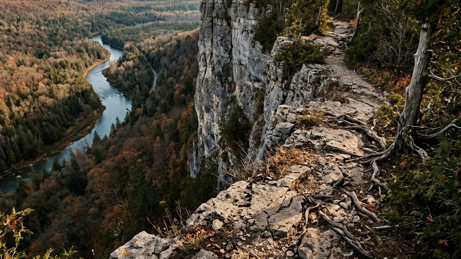
Pretty River Valley sits on the eastern face of the Niagara Escarpment. The Bruce Trail’s main line traces the upper ridge through the park, with several side trails dropping into the river valley below. The park has no developed parking lot — access is via roadside pull-offs along Sideroad 27 and County Road 19, with maybe 12 total parking spots scattered across three primary entry points.
The three named routes most local runners use:
- The Pretty River Valley Loop (8.4 km) — descends from the ridge into the valley, crosses the river twice, climbs back to the ridge. Roughly 220 m total elevation gain. The standard local Pretty River effort.
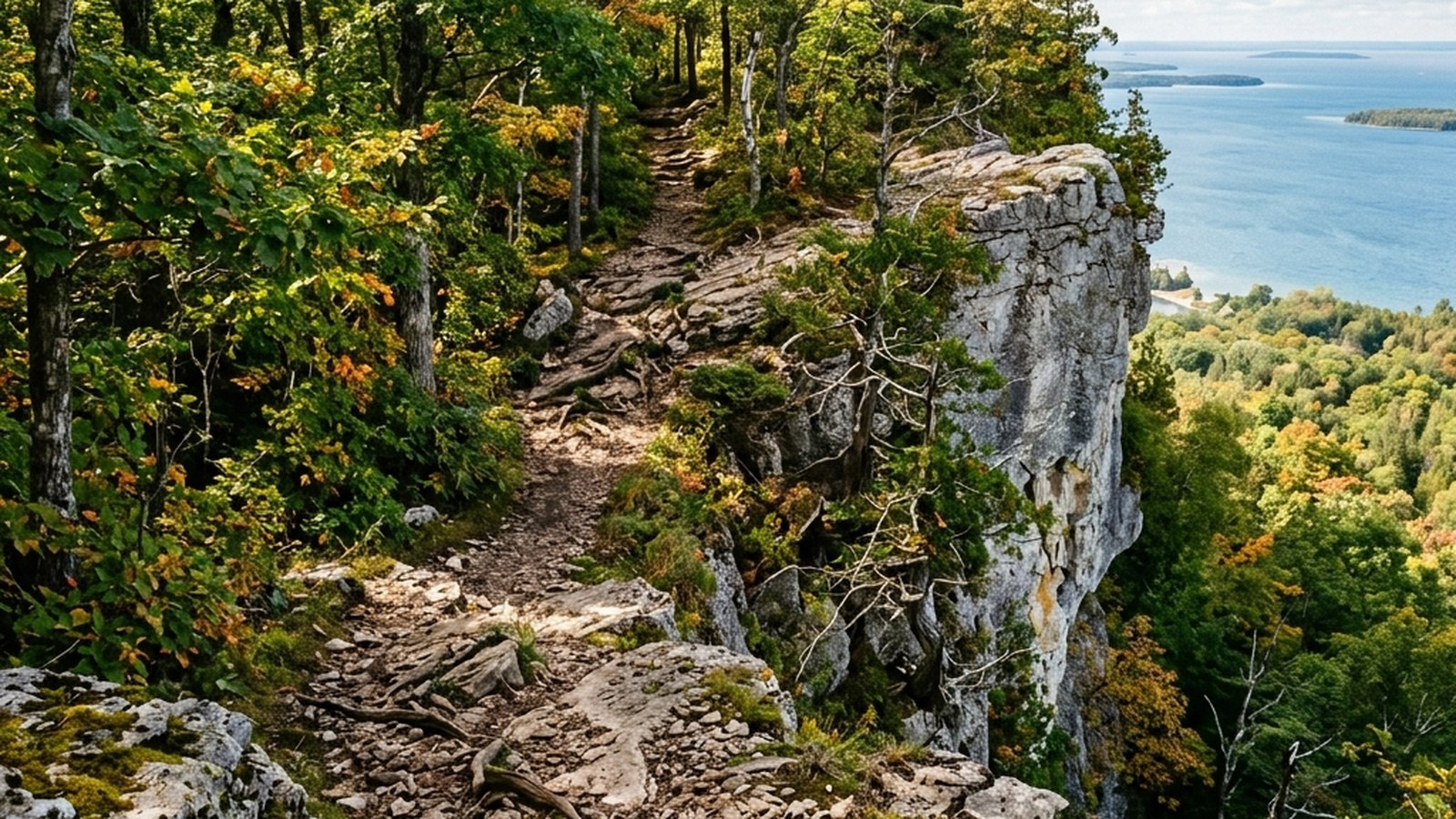
- The Old Baldy Out-and-Back (6.2 km) — sustained climb to a limestone outcrop with the best Georgian Bay view in the park. About 165 m elevation gain in 2.4 km of climbing. Hill-repeat venue for serious local runners.
- The Bruce Trail Northbound from Sideroad 27 (variable, 5-15 km out-and-back) — follows the main ridge with multiple turn-around points. The longest sustained ridge running available within the day-trip radius from Wasaga.
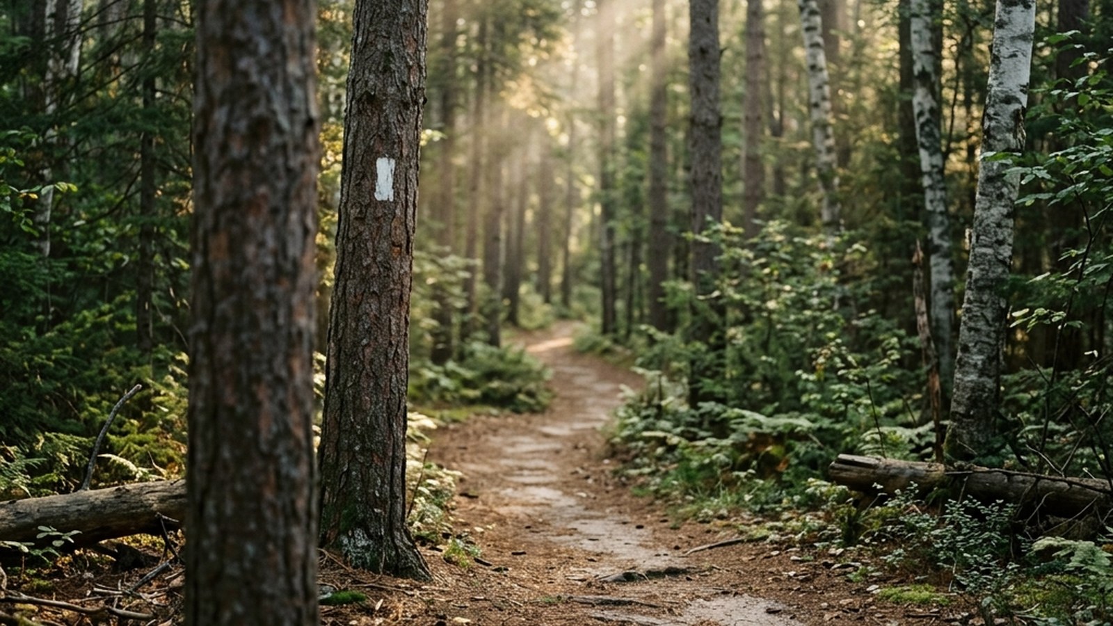
All routes are blazed in the standard Bruce Trail white-rectangle pattern. Side trails branching off the main Bruce Trail are blue-blazed.
What makes Pretty River specifically valuable
Two terrain features distinguish Pretty River from any closer-to-Wasaga option:
The valley descent. The Pretty River Valley side trail loses 220 m of elevation across 1.8 km, an average gradient of 12% with sustained sections at 18%. Few sustained-descent surfaces of this gradient exist in southern Ontario; most are concentrated on the Bruce Peninsula or the eastern Highlands. For Wasaga-area runners this is the only legitimate descent training within an hour’s drive.
The river crossings. The Pretty River loop crosses the river at two points. Spring runoff (March-May) makes both crossings calf-deep cold water; autumn runs are typically rock-hopable. The crossings build the foot-placement and proprioception skills that pure dry-trail running can’t produce. Plan dry shoes for the car — experienced local runners just commit to wet feet through the loop and change at the trailhead.
Why this is harder than Blue Mountain
Most Wasaga runners progress to Blue Mountain side trails first, then attempt Pretty River. The progression order matters: Pretty River’s descents are steeper, the trail surface is rougher (more exposed root and rock), and the navigation is less forgiving (fewer signs, less foot traffic to follow).
The recommended progression: 4-6 weeks of consistent Blue Mountain runs (one weekly long Sunday session) before attempting the Pretty River Valley loop. Skipping this stage produces ankle sprains on the descent more reliably than any other local trail.
For runners who’ve done Blue Mountain successfully, Pretty River is the natural next step — same terrain class, harder execution. For runners who haven’t done Blue Mountain yet, Pretty River is the wrong starting point.
When to go
April-early May: the river is high, ground is muddy, ridge sections are still patchy with ice. Skip these weeks unless you specifically want spring conditions.
Mid-May through June: peak season. Cool, dry, the maple-and-birch canopy is in early-summer leaf, the river is rock-hopable. Best running window of the year.
July-August: ridge sections are exposed and hot; the dark limestone radiates significantly above ambient air temperature. Early morning (before 7 am) is the only practical time. Bring more water than you think; the valley is humid in summer.
September-October: peak season again. Dry, cool, bug pressure low, the autumn canopy turns the loop visually striking by mid-October.
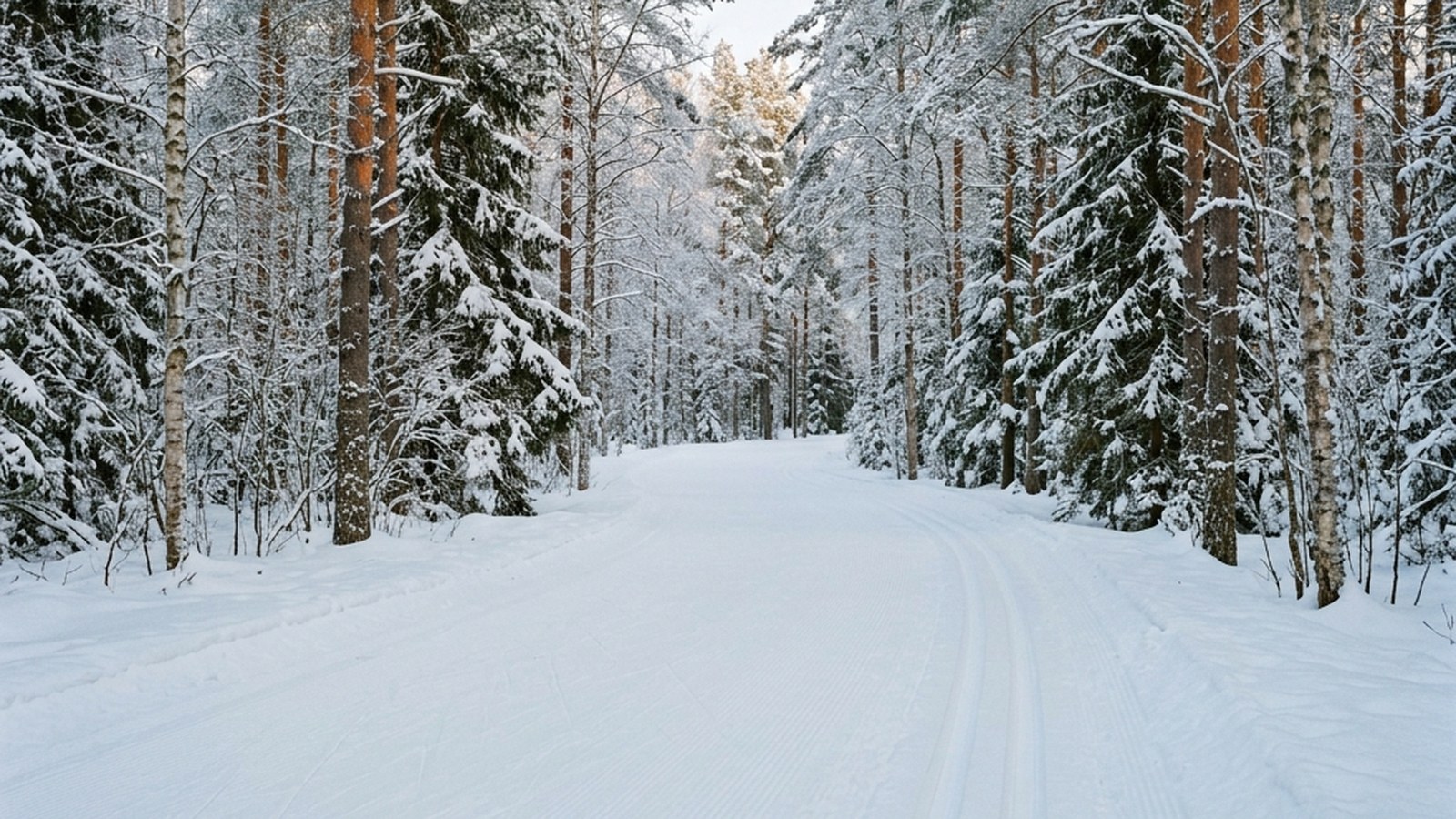
November-March: ice on the steeper descents makes the loop genuinely dangerous without microspikes or full crampons. Most local runners avoid Pretty River from late November through early April; this is the season to use the Wasaga Nordic Centre or the flatter Ganaraska section instead.
Wildlife considerations
Three species deserve specific attention at Pretty River:
Black bears are present in the park year-round. Spring and fall are the highest-encounter seasons. Make modest noise on blind corners; bear bells are sensible if you’re running pre-dawn or post-dusk.
White-tailed deer are common throughout the valley. Encounter is benign; just slow down to give them space rather than running directly at them.
Massasauga rattlesnake (Eastern Massasauga, federally Threatened) is documented in Pretty River Valley but encounters are rare. The species prefers the limestone-outcrop and dry-meadow margins on the upper ridge. They are not aggressive; bites are uncommon and rarely serious. Standard precautions: don’t place hands on rocks you can’t see, and step on logs rather than over them in spring and fall.
Practicalities
- Parking: roadside pull-offs along Sideroad 27 and County Road 19. ~12 spots total. Free.
- No facilities: no washrooms, no water tap, no warming hut. Plan accordingly.
- Cell coverage: spotty in the valley; reliable on the upper ridge. Bell more reliable than Rogers.
- Bruce Trail Conservancy membership: not required for day use but supports trail maintenance ($75/year individual). Pretty River is one of the higher-maintenance segments because of erosion on the steep sections.
- No fee: the park’s “non-operating” status means no day-use fee, no Ontario Parks pass required, no permit. This is the only Niagara Escarpment site in the region without a parking fee.
Recovery considerations specific to Pretty River
The combination of sustained descent + river crossings + technical footing makes Pretty River the highest-DOMS trail in the local rotation. Parker & Hardin (2017) showed that downhill running produces creatine kinase elevation 4-5× baseline at 24 hours and persistent quad-specific soreness for 5-7 days in untrained subjects. The Pretty River loop’s descent is enough to produce this profile in runners who haven’t built into the terrain.
Allow 72-96 hours between Pretty River sessions until you’ve done 6-8 of them across a season; after that 48-72 hours is sustainable. Don’t try to stack a Pretty River loop with another long run within 48 hours — the recovery cost is steeper than the time-on-trail suggests.
Local events that use the trail
The Pretty River Half Marathon (late October) is the local event of the year for the Pretty River system. Capped at 100 runners to limit trail damage; the route does the Pretty River Valley loop twice. Entry sells out within days of the registration opening in spring; if it’s on your radar, sign up the day registration opens.
The South Georgian Bay Trail Series spring opener (early May) sometimes uses Pretty River as a 10 km timed effort, depending on trail conditions. Both events are organised through the Friends of Pretty River volunteer group; the Facebook page “Pretty River Trail Stewards” coordinates volunteer trail-clearing days each April.
How to contribute back to the trail
Pretty River’s steep gradients mean erosion damage compounds quickly. The Friends of Pretty River volunteer group runs trail-clearing and erosion-control workdays each April and October. Volunteer turnout determines how much repair work the trail gets each year — a 4-hour Saturday morning swinging a pulaski produces more meaningful conservation than a year of trail-running on the surface. Sign-up is via the Bruce Trail Conservancy’s volunteer portal; no experience needed and tools are provided.
Practical takeaways
- 700-hectare non-operating Ontario Park 25 minutes south of Wasaga. Free, no facilities, ~12 parking spots.
- Three primary routes: 8.4 km loop, 6.2 km Old Baldy out-and-back, 5-15 km Bruce Trail northbound.
- Steeper than Blue Mountain. Don’t arrive without 4-6 weeks of Blue Mountain prep; ankle-sprain risk is real.
- Mid-May to June and September-October are the prime windows. Avoid winter and midsummer afternoons.
- 72-96 hour recovery between Pretty River sessions until you’ve built into the descent loading.
References
Parker 2017Parker DJ, Hardin EC. Eccentric muscle damage and downhill running: a meta-analysis. European Journal of Applied Physiology. 2017;117(2):241-256. View source →COSEWIC 2012Committee on the Status of Endangered Wildlife in Canada. Eastern Massasauga assessment and status report. 2012. View source →Bruce Trail ConservancyBruce Trail Conservancy. Trail standards, side-trail registry, and Pretty River segment management. View source →